Treaty of Limits
Tratado de Limites, 2011
The starting point of this Project was a trip through the pampas region (which encompassed the southern part of the state of Rio Grande do Sul, southern Brazil, and northern Uruguay). Traveling throughout this region made me reflect on geographical and political limits between states and countries.
The pampas region creates its own geographical boundaries that determine its specific biome, making other means for defining its borders seemed senseless. The spatial continuity of the pampas’ fields and landscape evokes the perception of diluted borders, reminding one that borders are not always perceptible, nor pertinent, and that this region’s own characteristics had once been enough to identity it, without the necessity of politically drawn borderlines. “Treaty of Limits” was comissioned by 8th Mercosul Biennial.
Characterizing many of my works is the specific perception that emerges from issues relating to the places where I’ve traveled. Two texts, “Tratado de Limites entre o Brazil e a República Oriental do Uruguay” (Treaty of Limits between Brazil and the Oriental Republic of Uruguay) and “Extremo Sul do Brasil (Limites do RS)” (Extreme South of Brazil (Limits of RS), inspired this project. These treaties give an account of the boundary delimitation process as defined by political and geographic limits in southern Brazil and Uruguay.
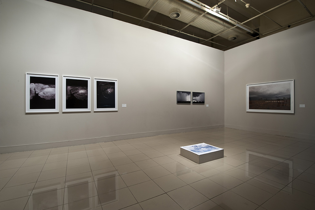
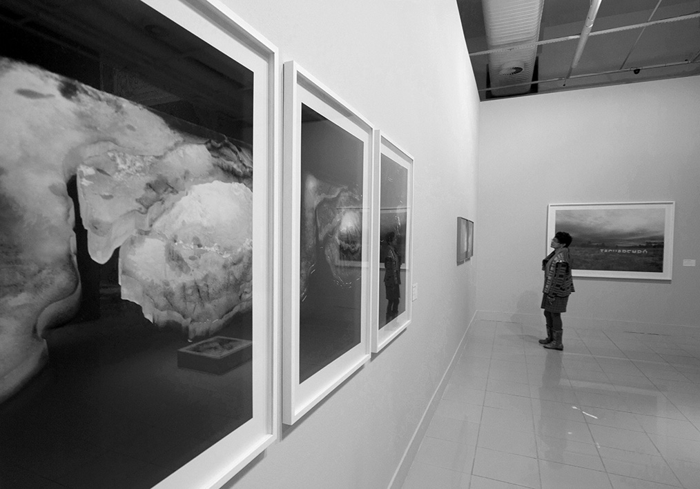
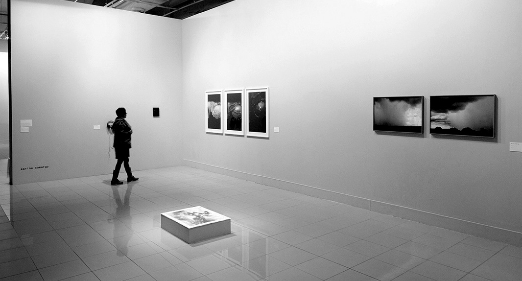
Exhibition photographs by Fabio del Re | Flávia Quadros | Cristiano Santana
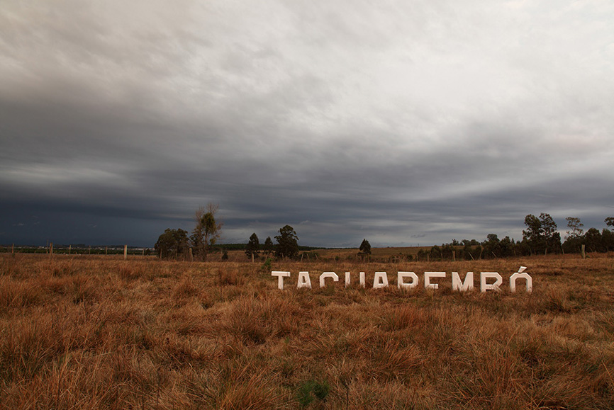

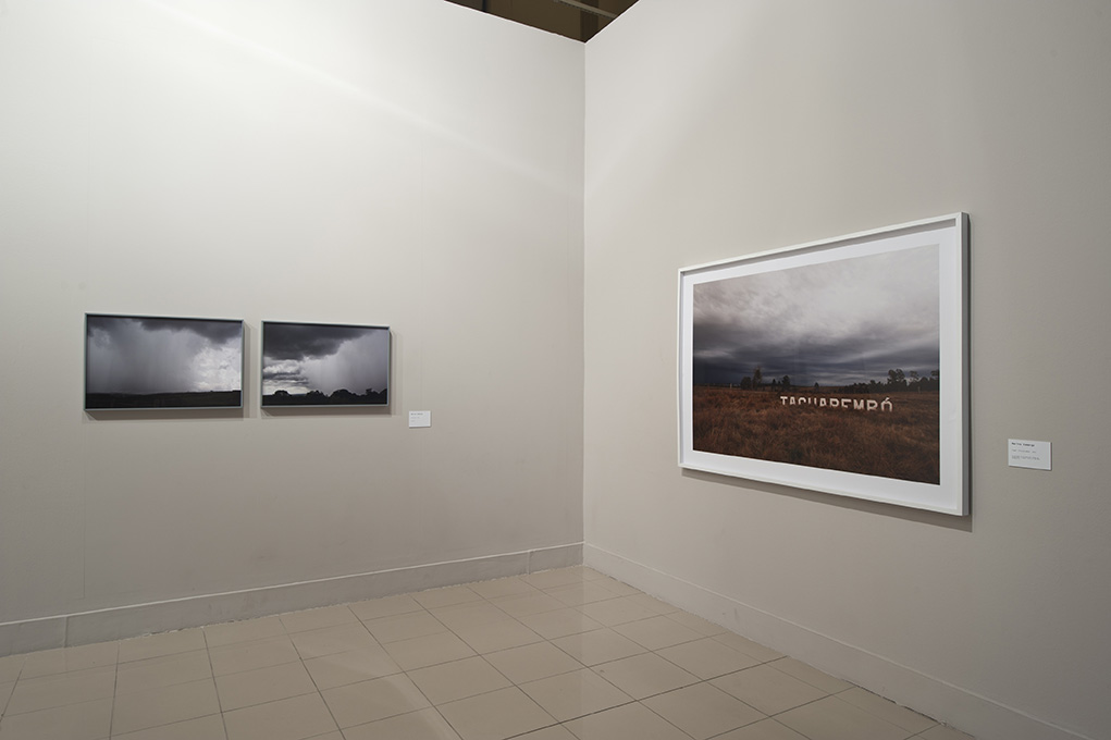

PLACE: TACUAREMBÓ
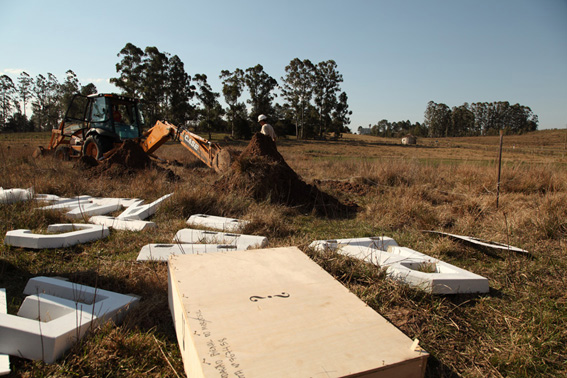
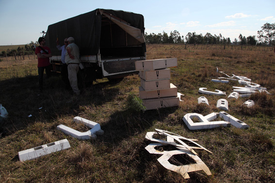
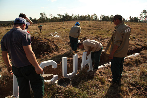
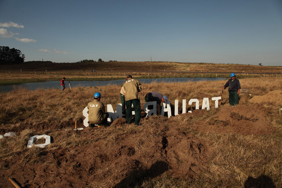
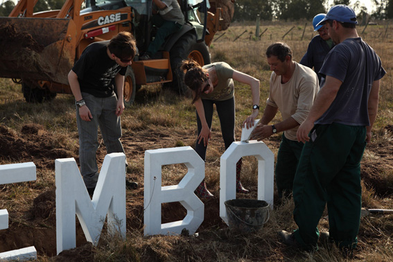
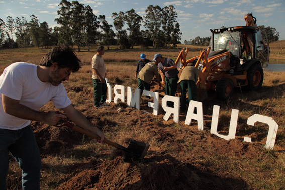
Installing Place: Tacuarembó, in Uruguay.
This piece was also conceived considering my political position in relation to the proposal of the Mercosul Biennial – whose very name designates an economic treaty, the Southern Common Market (MERCOSUL). All issues related to executing this work (such as transport, customs clearance, exporting materials for works of art, etc.) were extremely complex and made even worse due to the fact that, in practice, this treaty does not work. Although, in theory, the Mercosul’s objective is to facilitate foreign trade and exchange between countries involved in the treaty, in reality, exchanges are practically inexistent and made difficult in the context of cultural, political and economic exchanges. In this sense, realizing this installation for the Mercosul Biennial outside of Brazil was, for me, a necessary action provoking reflection about what it means to exhibit art within the context of the Mercosul, explicit in the very name of this Biennial.
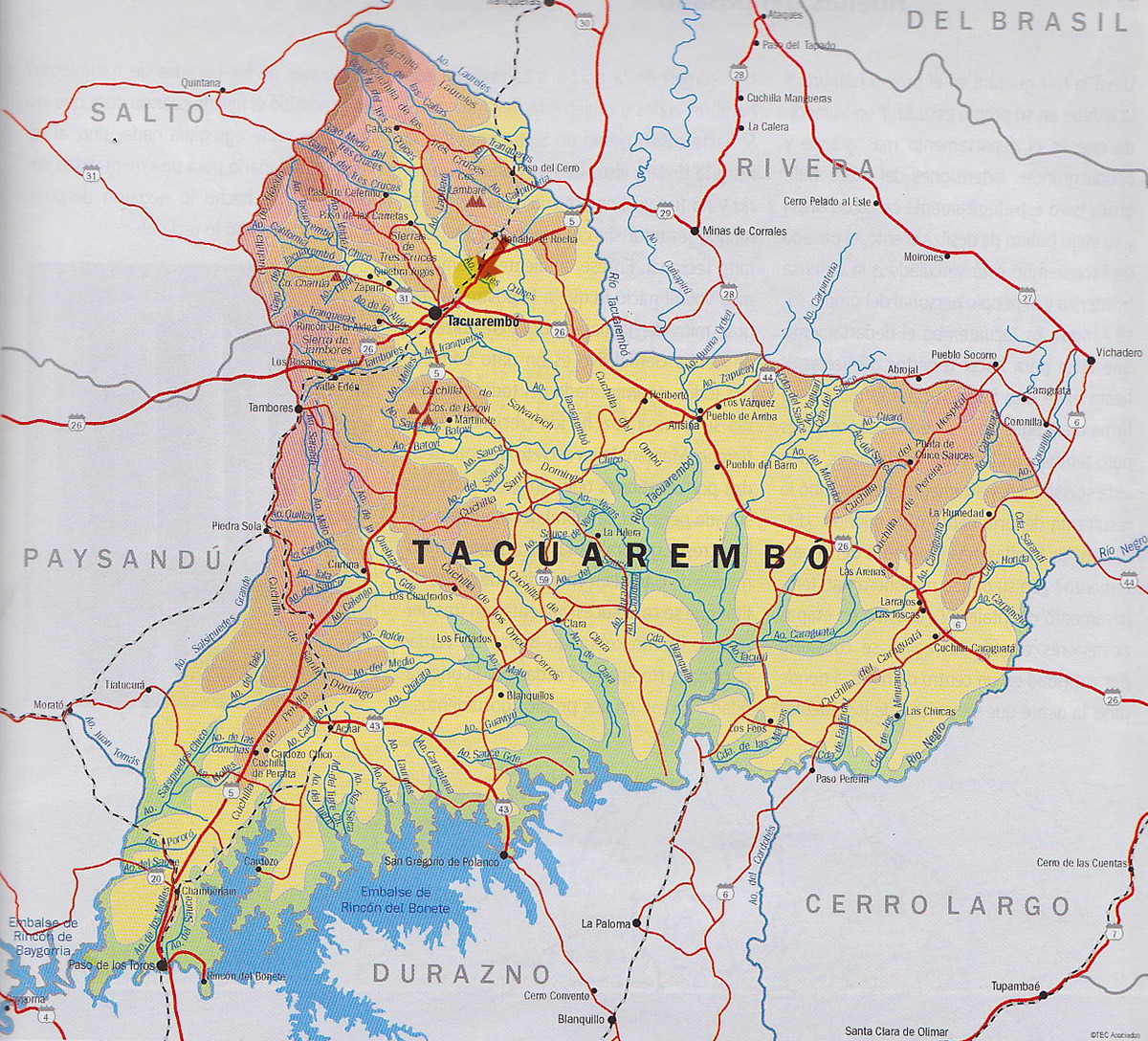
Tacuarembó, in Uruguay, is the geographical center of the pampas. In the past few decades, it has also come to be known as the pampas’ capital. For Gauchos, referring to the gaucho culture and people from Uruguay, Argentina and the state of Rio Grande do Sul (Brazil), this city is a cultural reference, a crossroads of converging events in the pampas: considered the very capital of this autonomous region, where three distinct countries have combined their cultures to discover their own common cultural identity.
Tacuarembó is a city (as well as region) where many indigenous archaeological sites remain buried – although already mapped, they have not been unearthed due to issues of protection and cultural preservation.
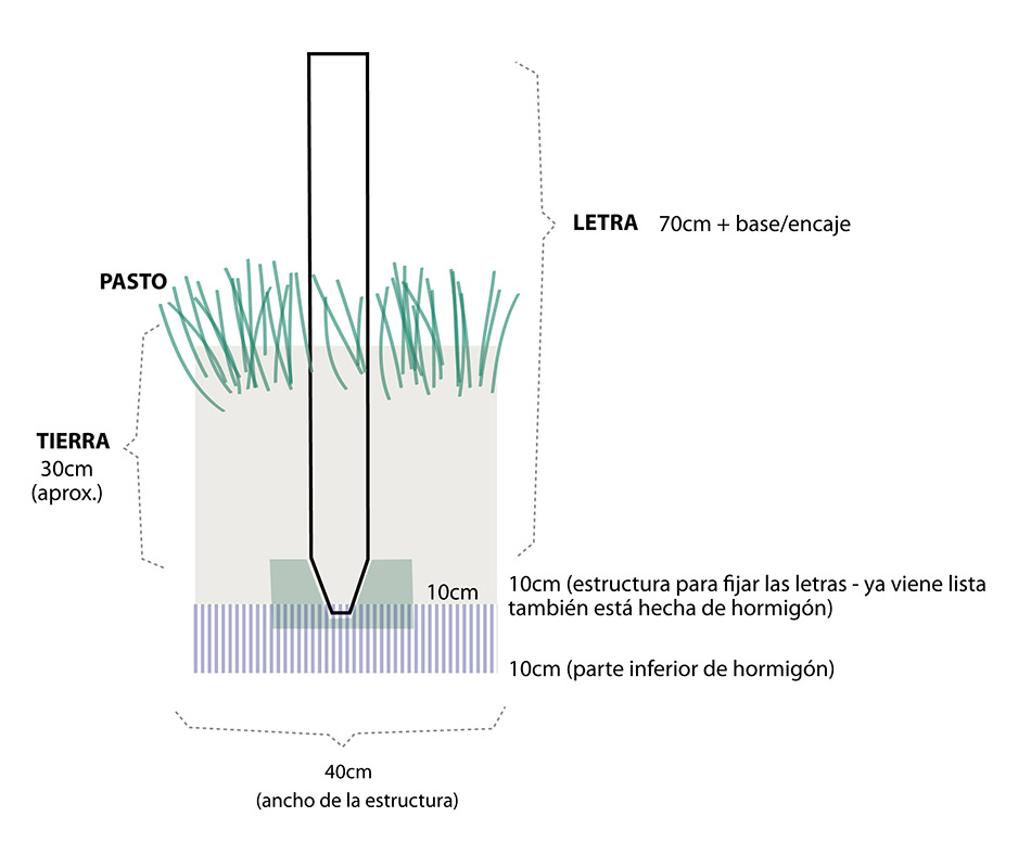
The work in Tacuarembó is based on signs that show the names of cities (the kind often placed on a main road to show the entrance to cities in the Brazilian countryside). The sign consists of large letters made of concrete, set up on the ground, forming the locality’s name. In the work, concrete letters spelling out “TACUAREMBÓ” were partially buried at the entrance of the city so that only one third of the sign can be seen above ground. Besides the installation in the city, the photograph “Lugar:Tacuarembó” (“Place: Tacuarembó”) is also a work in itself, somewhere between the photographic record and photography as artwork, autonomous in relation to the installation.

GEOGRAPHY
(LANDSCAPE WITH WAVES)
LANDSCAPE WITH WAVES
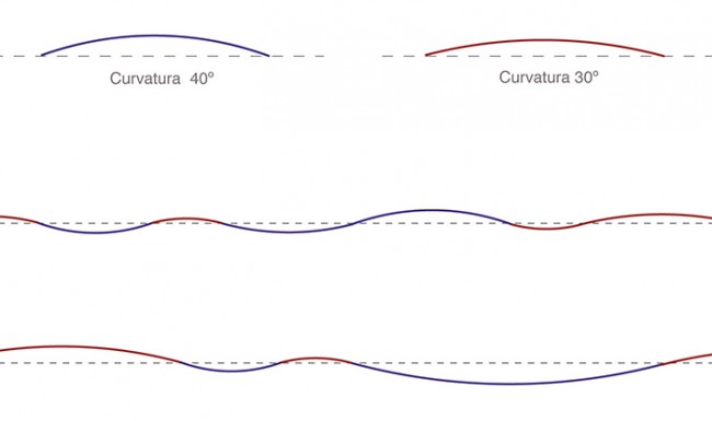
The wind in the Pampas (Southern South America) inspired “Landscape with waves”. This work was thought having as reference the geographic landscape from this region, located between the latitudes of 30º and 40º.
“Landscape with waves” was created after Marina Camargo’s proposition for the musician Leonardo Boff to create a “sonorous landscape” using computer graphics that draw waves at 30º to 40º angles.
“Landscape with waves” was made using simulations of the sound of wind combined with the timbres of the flute and the guitar (of the song “Negro da gaita”, by Cesar Passarinho) and sound manipulation. The sonorous landscape begins with a sound construction of a recognizable landscape (the wind blowing, that defines this imaginary space), transforming in a continuous process of deconstruction.
What constantly impressed me during the journey throughout pampas was the fact that a border really represents a passage between one place and another that I could actually see – not only as a political division between two territories, but also as one intrinsic to the place’s geography. Borders are delimited by bodies of water, such as the Uruguay River that separates Brazil from Uruguay. This same river in Argentina, as well as in the border city Jaguarão, delimits borders in the extreme south of Brazil
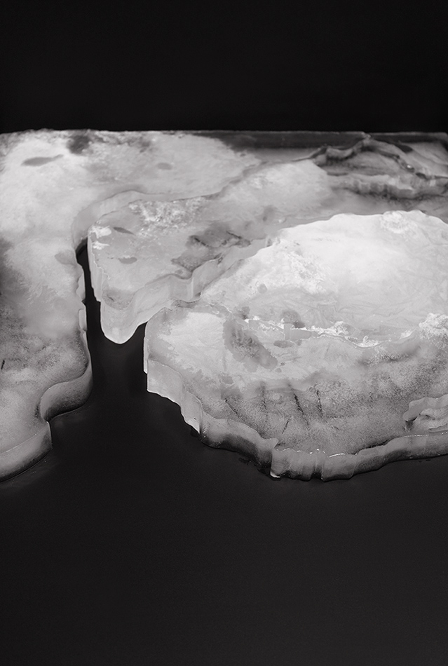
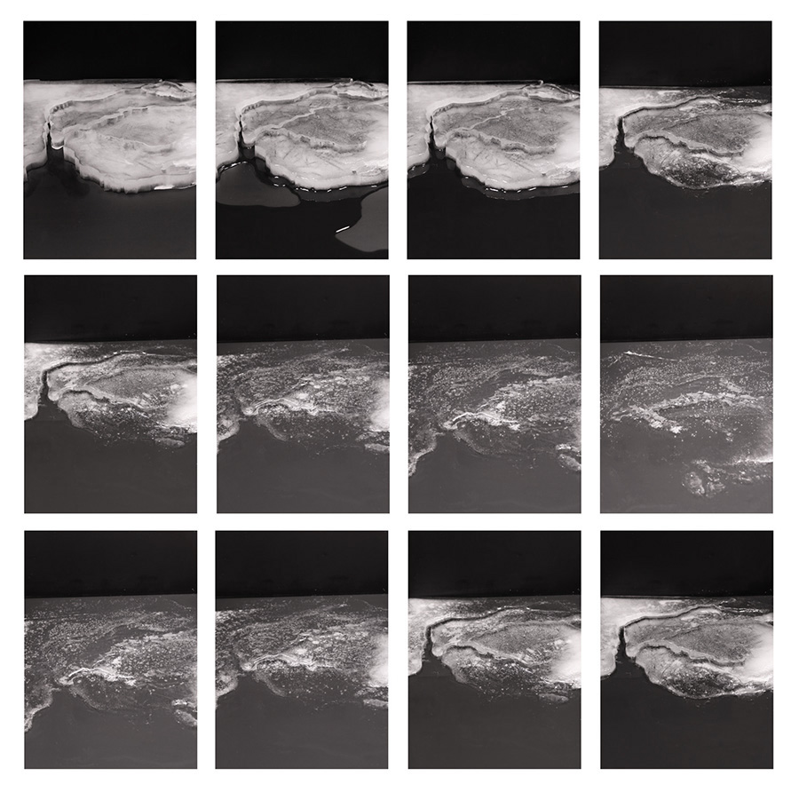
One of these works is a map made of ice showing the cold southern region of the Mercosul (South America’s Common Southern Market) whose delimiting borders are formed by oceans, lakes or rivers. As the ice melts, these boundaries are lost. It is shown as photographs and as a video, together with the soundscape “Landscape with waves”.